Five Years of Monitoring Montana Waters
For five years,
the Monitoring Montana Waters (MMW) program has been a force for promoting clean waters, ensuring environmental health and promoting volunteer-led science in Montana. Since its initiation in 2020, this program at the Flathead Lake Biological Station has aided 19 community water monitoring programs across Montana, providing technical assistance, lab support and funding to ensure these programs collect rigorous, scientifically sound data that support their goals and are used for management of our waters. In its first five years, MMW has funded the analysis of over 8,000 samples from some of the most valuable and sensitive rivers and lakes in Montana, including the Big Hole River and Flathead Lake. This retrospective looks back on the successes and impact of MMW over the first five years, highlighting the program’s goals, evolution, and future direction through the lens of five community monitoring groups who utilize MMW’s resources to support their water monitoring and environmental protection efforts.
The origins of the Monitoring Montana Waters
lie in a 2020 charitable donation to the Flathead Lake Biological Station. This funding from PlusFish Philanthropy made it possible for the FLBS to launch a new program dedicated to providing Montanans with the resources needed to conduct monitoring efforts that could make a difference. Assistant Research Professor Rachel Malison (then a post-doctoral researcher at the FLBS), took on the task of turning the short description the donor and FLBS Associate Director Tom Bansak created into a functional program to support water quality monitoring efforts around the state. “I’m an organizer at heart … that’s just in who I am,” Malison said. She said that the challenge of developing the program did not intimidate her, although building new relationships with other institutions, state government and community groups was a bit more challenging to get started. After a year of planning, Malison and her team of FLBS staff and Big Sky Watershed Corps members launched the program in 2021, which initially involved seven community water data collection efforts. Although MMW has expanded in the types of sampling involved and in the geographic scope of groups involved, MMW’s basic mission and the ways that groups interface with its staff has remained consistent.
(MMW) has given staff more confidence in advocating for this place. The more we know about the valley, the more passionately, clearly and uninhibitedly we can talk about the valley.
- Anthony South, Yaak Valley Forest Council
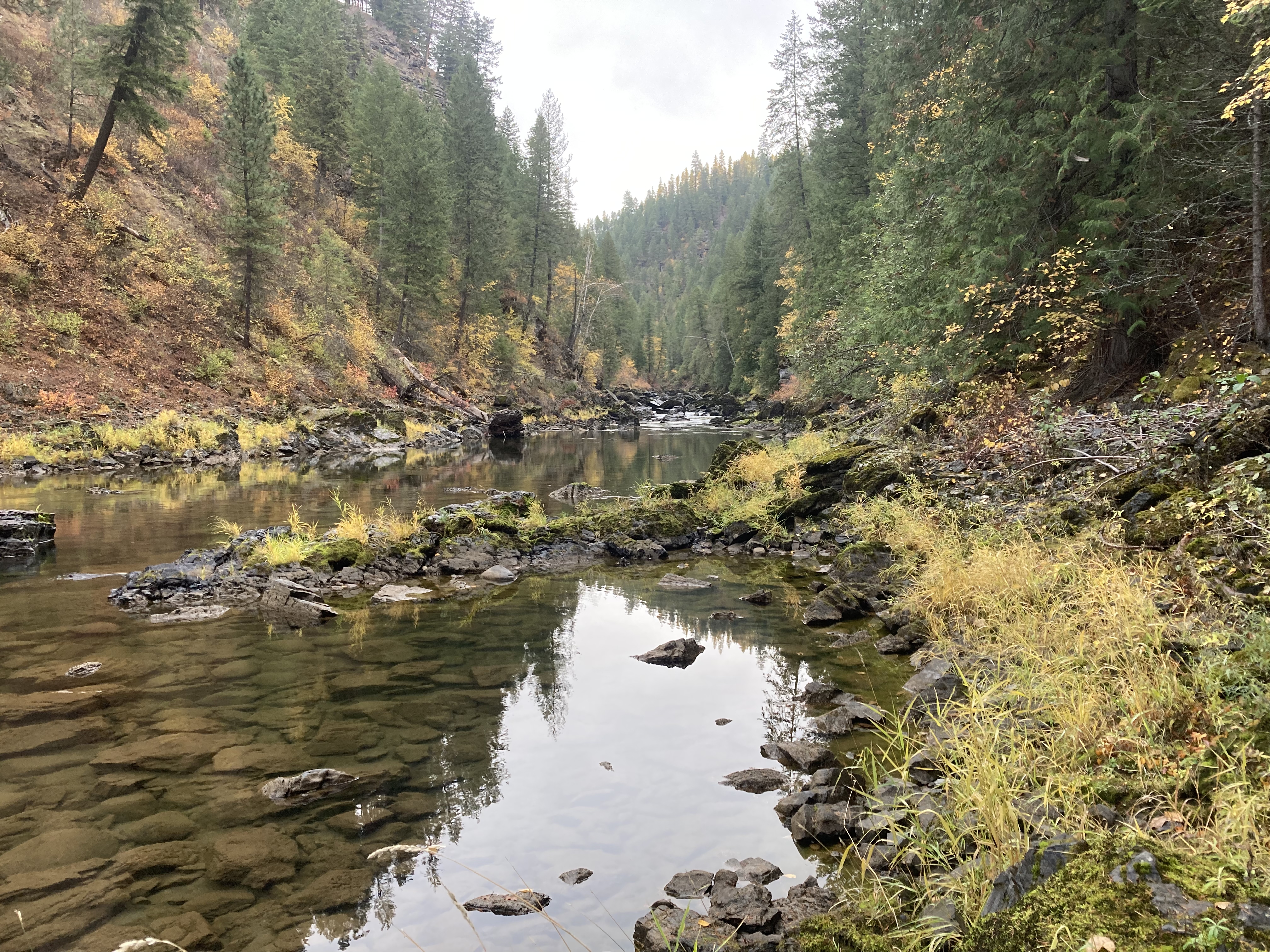
Standing by the banks of the Kootenai River
in Troy, Montana, Anthony South looks out over the clear water and watches his dog Abbey chase a frisbee into the stream. South is the Headwaters Director for the Yaak Valley Forest Council (YVFC), a nonprofit organization based in Troy that, among other efforts, works on stream restoration and maintaining high water quality in the Yaak Valley’s rivers. The support of Monitoring Montana Waters has made many of the group’s water monitoring efforts possible, South explained.
Monitoring the health of waters in the Yaak Valley has been core to the YVFC’s work since its inception, South said. Over the years, these efforts included testing the amount of sediment in streams to support decommissioning roads that cross them, surveys for fish barriers and sampling for aquatic invasive species like rainbow trout or zebra mussels. YVFC has also done extensive work on riverbank restoration in the area, using low-tech restoration methods and manual labor to restore degraded riverbanks on private land.
The Monitoring Montana Waters program “plugged in perfectly” into the Forest Council’s ongoing efforts, South said, filling a “big gap” in the group’s data by helping them test key water quality (characteristics) like the amount of nitrogen and phosphorus in the water or how much oxygen is available for fish and other aquatic organisms. MMW’s close alignment with their goal drove the Forest Council to become one of the inaugural groups in the program when it launched in 2021.
MMW also helps the group test selenium levels in the Kootenai River, South said. High levels of selenium can damage fishes’ ability to reproduce, potentially causing the widespread collapse of fish populations with sufficient contamination. South said that selenium is a major concern in the area due the high amounts of selenium laced runoff coming from open pit coal mines in the Elk River Valley area of British Columbia, Canada. This runoff flows into the headwaters of Kootenai River and makes its way into Montana.
South said that the technical assistance and support the program offers makes sophisticated water monitoring achievable for groups without extensive technical skills. “Almost anybody and everybody can go out and do it.”
Each year of MMW monitoring
begins with groups submitting a sampling analysis plan and a set of standard operating procedures to MMW staff for review. These documents outline the goals for a group’s sampling effort, what characteristics they will sample and where their sampling sites will be, as well outlining the details of their sampling procedures.
MMW’s 2024/2025 Big Sky Watershed Corps Member Brianna Elizondo said that MMW tends to start work with new groups through Zoom calls where they help walk them through the templates for the sampling analysis plan and standard operating procedures, and answer questions. Once the group starts drafting these documents, staff keep meeting with them and commenting on the drafts to help refine them, Elizondo said.
MMW also helps groups determine what water characteristics they might need to sample to understand the issues they are seeing. “Lots of groups when they come to us don’t really know what nutrients are behind the issues they’re seeing,” Elizondo said. She said that MMW staff typically guide groups to start with testing levels of nutrients like nitrogen or phosphorus along with testing total suspended solids if they are concerned about sediments or various metals if mining waste is an issue.
Once the sampling analysis plan and the standard operating procedures drafted and being edited, groups are eligible to apply for funding to pay for the analysis of the samples they collect in the lab. The costs of sample collection, like time and driving, are covered by the water sampling group. Groups may apply for grants from MMW to cover purchasing sampling gear every three years to help cover costs of things like water quality meters. Most of the sample processing and analysis is done at the FLBS Freshwater Research Lab, Elizondo said, although certain tests, like for selenium and other metals, are processed by the Brooks Applied Laboratory in Seattle.
Once the sampling season starts,
the YVFC team coordinates heavily with the “amazing” MMW staff, South said, arranging shipping of the coolers and bottles that store water samples to the council and managing of the logistics of shipping the samples back to the lab so that they arrive within a week of collection.
The YVFC takes samples twice a year at 23 sites along the Yaak and Kootenai rivers and their tributaries. Samples are taken in the spring during high waters and in the late summer or fall when water in the river is at its lowest, South said, capturing the river’s variations. Three to four YVFC staff typically take the samples, he said, although they were joined in the spring of 2025 by a volunteer from Glacier National Park as well. Sampling starts at the northern sites near the Canadian border and works south.
Once the samples are collected and the processed, results are sent back to YVFC. South said that he goes over these results and compares them to Montana Department of Environmental Quality standards to detect sites and (characteristics) that may be abnormal. He also enters them into the DEQ MT-eWQX database that tracks water quality throughout Montana and into a recently launched stream data dashboard on the Forest Council website. Results are then also available in the national water quality portal.
The data gathered with MMW
has “given staff more confidence in advocating for this place,” South said. “The more we know about the valley, the more passionately, clearly and uninhibitedly we can talk about the valley.” The data has helped open discussions with the public and community partners about selenium and other water quality issues, South said, in addition to being integrated into updated restoration plans for the area.
“Our work is kind of just the foundation, the cornerstone for what’s to come,” South said. The valley is changing rapidly, with warming temperatures, a growing population and increasing threats, both from contaminants like selenium and invasive species. South said that he hopes the data that YVFC collects using MMW can be part of the solution, providing a basis for ongoing advocacy and protection of the unique sub-boreal inland rainforest environments in the valley.
Driving along a backcountry Yaak Valley road in his 1993 pickup, South points out the North Fork of the Yaak River, which he said is the most heavily impacted of the Yaak’s four forks by agriculture in Canada. Although the fork has a lot of beaver activity, South said that phosphorus levels are high and the fish population is small. Understanding these issues is part of what drives the YVFC’s testing work South said. “That was part of our rationale or justification for testing was to try to have an undeniable finger pointed at something.”
Establishing baselines
is one of the key purposes of data collection by groups participating in the MMW program. Our world and environment are rapidly changing, whether by warming temperatures or local influences like the growing populations and development occurring through much of Montana. Since our actions on land influence water quality, many of these changes have the potential to impact our rivers and lakes and the animals that live in them. High summer temperatures can stress populations of cutthroat trout and other fish valued by anglers and conservationists while the nitrogen and phosphorus contained in wastewater and fertilizer can cause harmful algal blooms. However, understanding these changes and risks to our waters requires having rigorous baseline data to understand conditions. MMW helps communities build those extensive baseline datasets, helping interested groups determine what characteristics they should monitor and helping them implement monitoring using scientifically credible methods. This effort provides communities with the data they need to understand environmental changes and human land-use impacts as they happen and prepare community groups, local and state governments to effectively respond to them.
Without access to that kind of financial support, we wouldn’t even be able to begin to do what we’ve done.
– Jeff DiBenedetto, Rock Creek Watershed Group
Change is coming
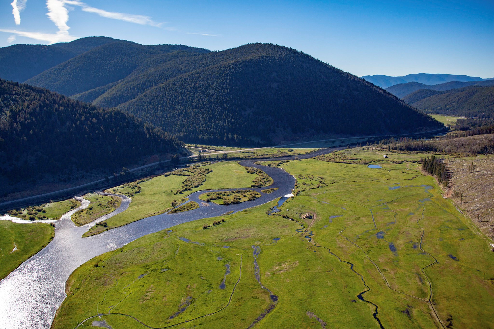
in the Rock Creek Valley, Jeff DiBenedetto explains. Rock Creek flows out of the Absaroka Beartooth Wilderness north of Yellowstone National Park, winding northward for 55 miles through a mix of small towns, subdevelopments and agricultural lands until it empties into the Clarks Fork of the Yellowstone River about 30 miles east of Billings. The area is seeing growing development, and the potential for increased oil drilling in the Beartooth Front, DiBenedetto said. The area has also seen new environmental challenges, he said, such as large-scale flooding from Rock Creek through the valley’s largest town of Red Lodge in 2022.
DiBenedetto’s group, the Rock Creek Watershed Group, is working to prepare the valley for these changes by building strong baseline data on water quality in Rock Creek. In 2021, DiBenedetto said that members of group concerned about the impacts of development on the the creek and the connected aquifer began looking for water quality data about Rock Creek. They found that the Montana Department of Environmental Quality, which regulates the permitting of septic systems and other water related systems, had no data on water quality in Rock Creek.
Without data, DiBenedetto said, it’s impossible to tell how conditions in the creek may be changing or what impacts increased development, more septic systems or other stressors may be having. Long term planning, such as work on grow policy by the Carbon County government, is also difficult without baseline data, he said.
Seeing this gap,
the watershed group decided to launch its own water quality monitoring effort focused on Rock Creek in 2022, DiBenedetto said. This effort was supported and facilitated by Monitoring Montana Waters, which provides technical support, funding and volunteer training for the watershed group and its parent organization, the Carbon County Resource Council. The project involves sampling of 11 sites on Rock Creek and its tributaries, including locations in the national forest, near subdevelopments and in regions with heavy agricultural activity. Between April and October, eight volunteers from the group take samples every month, testing nitrogen and phosphorus levels, pH, water temperature and other characteristics. Most of the sampling group members are retired and live in the area, DiBenedetto said, although they were recently joined by a younger volunteer connected to the local Trout Unlimited chapter.
“Without access to that kind of financial support, we wouldn’t even be able to begin to do what we’ve done,” DiBenedetto said, referring to grants MMW provides for sample analysis and gear. The technical support and field training that MMW staff provide has also been “really good” for the watershed council, he said, helping them refine their sampling techniques and understand their data. This multifaceted support “helps local groups like ours get off the ground and get something going,” DiBenedetto said.
With three years of baseline data collected, the group is moving towards an “educational phase,” DiBenedetto said, even as they continue to gather more data. This educational phase includes efforts to engage both the public and local government officials about the importance of water quality and to teach them about the current water quality conditions in Rock Creek. DiBenedetto said that the baseline information is critical for this effort, as it “gives us factual information if we’re talking to the county planning board” or other similar organizations. He said that the county commissioners have developed a greater interest in water issues in recent years, including concerns about future water supply and how increased groundwater consumption may reduce local aquifers.
One recent success
in this effort was a water quality forum the group and the Carbon Country Resource Council held in February, 2025. The event featured multiple speakers, including MMW Program Leader Rachel Malison, who spoke on how MMW supports volunteers to monitor water quality. The event “kind of surprised us because we packed the room,” DiBenedetto said. About 70 people came to the “standing room only” event and more were turned away due to lack of space, he said.
Successful events like this are a sign that water quality is “maybe getting a bit more headway” to DiBenedetto. He said that the group plans to continue its educational work and sample collection in the future and is working on being included in future water planning efforts both by DEQ and local governments. He hopes that these plans will help facilitate further stream restoration efforts in the area and increased water quality standards for the area where measures to mitigate water quality impacts are based on best practices and data. The baseline water quality data the group has collected will be central in moving forward these advocacy efforts forward and forming a base for this work, DiBenedetto said. “There’s no point in collecting the data unless you’re going to make use of it.”
The data that MMW helps community groups collect
is often funneled into efforts to educate and inform the public about local water quality issues and the health of their watersheds. After samples are analyzed in a lab, groups plot and analyze their data to show and think about how to communicate their findings to interested people and leaders in their communities. MMW helps groups interpret what the levels of compounds found in the water mean and what threat they might pose the environment and the organisms in the water. MMW also consults with groups to help them craft strategies to translate their findings into an accessible, impactful form. Ideas and options for outreach efforts were highlighted during a portion of the annual training event held at FLBS in May 2025. However, outreach and education are ultimately driven by the community groups that MMW supports. Their passionate advocacy and deep connections within their communities are key to translating the data they collect with MMW support from valuable scientific information to community engagement, expanded knowledge and local, regional and state-level action to protect Montana streams and rivers.
Our problem is how many people love this place and our solution is how many people love this place.
– Geoffrey Gill, Flathead Rivers Alliance
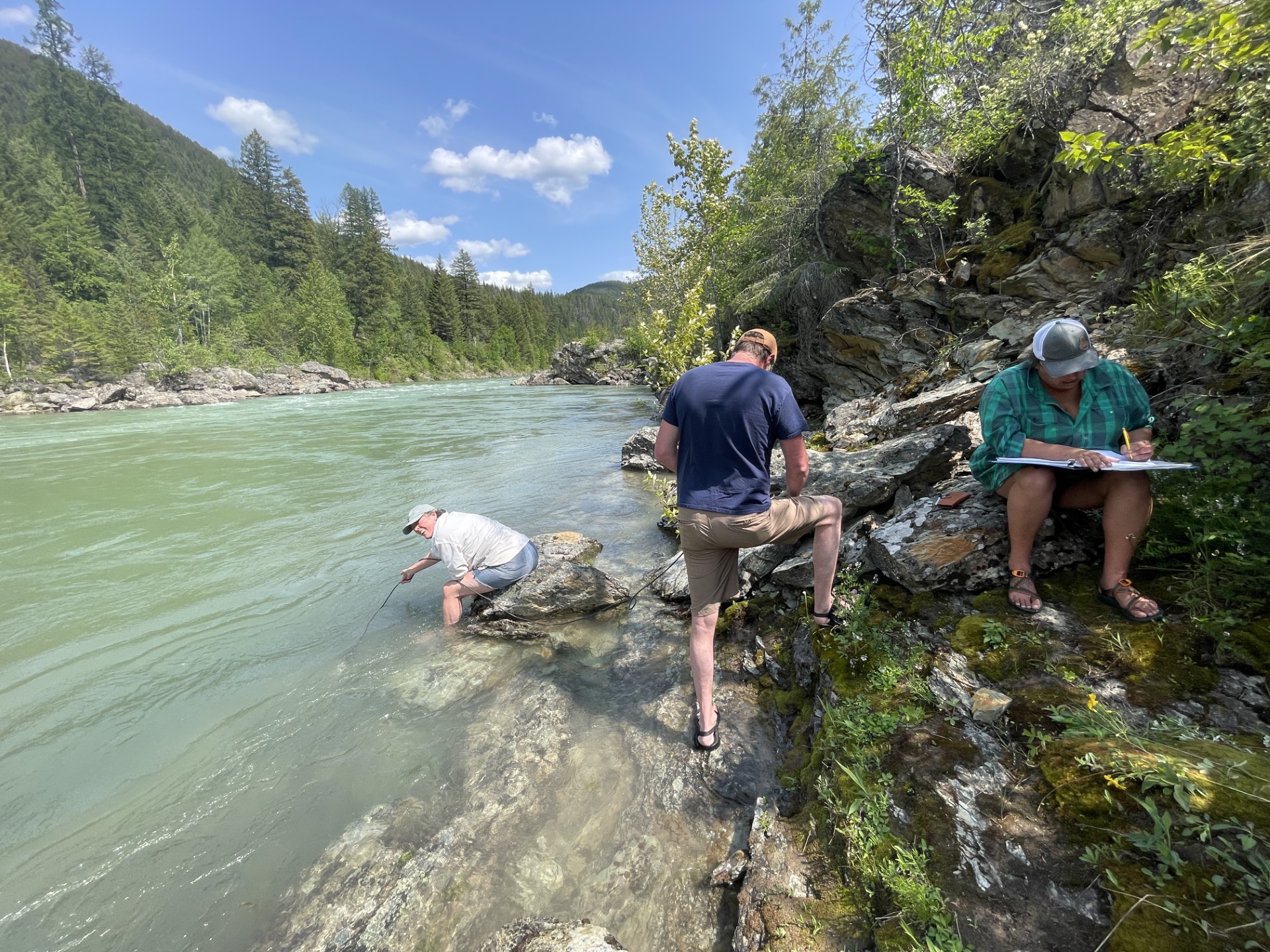
Most rivers monitored with MMW support are struggling
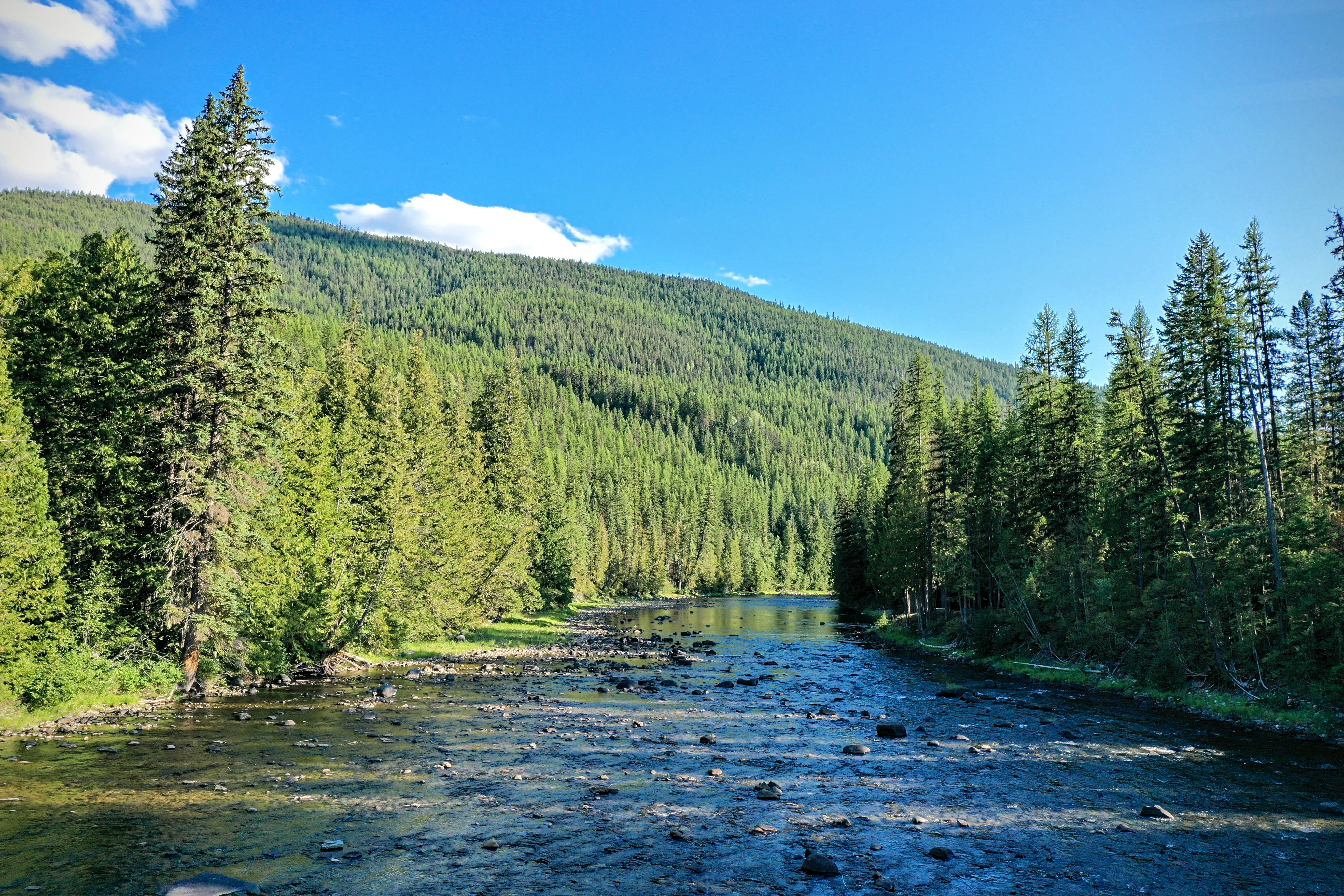
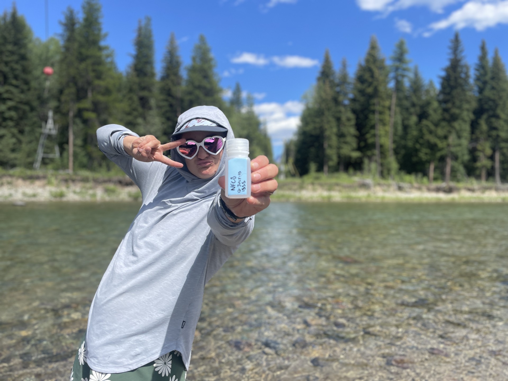
in some way, impacted by significant water quality threats or other degradation. “We’re part of the MMW program for a very different set of concerns,” said Flathead Rivers Alliance (FRA) Volunteer Coordinator Geoffrey Gill. The group monitors the water on the North, Middle and South forks of the Flathead River. The North Fork runs southward on along the western edge of Glacier National Park while the middle and south forks run northwards from the Great Bear Wilderness and into the Flathead National Forest before eventually joining the North Fork. RA tests a total of 11 sites across the forks, including four sites on the North Fork, 6 sites on the Middle Fork and one on the South Fork.
The forks of the Flathead River are notably pristine, witnessed by their inclusion in the National Wild and Scenic Rivers system. Although the water is currently clean and clear, Gill said that the goal of the monitoring project is to keep it that way. “We are doing well with water quality … and we need to be out here so we can know early and act early.”
The sampling program is on its third year,
Gill said, and is working to expand volunteer participation. In 2023 and 2024 the sampling was primarily done by FRA staff, with a cadre of volunteers taking over the work in 2025. Gill said that his goal in the future is that this cadre of volunteers will be able to take more lead of the program and help train new volunteers.
The current volunteer group is deeply engaged with the details and nuances of water quality and conservation on the Flathead, Gill said. This group includes board members of local conservation organizations, people involved with the West Glacier Community Preservation Association and a member of the North Valley Search and Rescue. As the program grows, Gill said that he hopes to draw in a wider variety of people and make the program a “good entry point to river conservation.”
Beyond monitoring the river’s health, Gill said that the monitoring project helps the FRA with another of its projects, ensuring that visitors responsibly use the river. Glacier National Park sees 3 million visitors a year, Gill said, and the West Glacier boat ramp, which is one of the most accessible starting points for rafting the Flathead, serves between 9,000 and 10,000 people a day during the summer. “That is a staggering amount of folks,” Gill said.
FRA operates a volunteer river ambassador program,
which places liaisons at popular river put ins and take outs. These liaisons provide information to boaters, remind them about regulations, help them chart routes and offer life jackets for loan. One key issue on the river, Gill said, is human waste. On the North and Middle forks of the Flathead, boaters must have an approved portable toilet system to transport waste for safe dumping instead of dumping it on the banks or otherwise leaving in the area. Given the high level of traffic on the river, Gill said that the accumulation of waste is a significant threat and could degrade the otherwise pristine waters. River ambassadors help inform rafters about this regulation and give them resources like so-called “wag bags” to contain waste. Gill said that FRA’s water monitoring can help river ambassadors discuss this issue and guide river users towards responsible behavior. Explaining that the group monitors water quality in the river and the importance of this water quality can nudge people towards responsible behavior, Gill said.
Terry Richardson, one of FRA’s longest serving river ambassadors said that river users, whether tourists or locals, are respectful of the river and want to obey the rules and preserve the river. “People are very open” to learning more about the river and receiving guidance on how to follow rules and prevent damage, he said. The wild and scenic river designation is one of the less understood aspects of the river, said Richardson, but most people are willing to learn more about what it means and what actions are needed to protect it. The river ambassadors also have a significant role in keeping people safe on the river, Richardson said, distributing equipment like life jackets and providing advice.
FRA water monitoring
volunteer and North Valley Search and Rescue member Andy Marvin said that, although traffic on the river has increased in recent years, the river conditions have remained largely pristine. Trash on the North Fork of the Flathead has increased somewhat in the last couple years, Marvin said, but the amount remains much lower than many other heavily trafficked rivers. Finding a few cigarette butts or pieces of plastic is a large haul of the trash on the Flathead, Marvin said. The “biggest outrage” on the river recently was when a bus accidentally rolled into the river for a few hours at a takeout, said Marvin and Richardson. Conditions on the more remote South Fork of the Flathead are more difficult, Gill, Richardson and Marvin agreed, with larger problems with trash and dumping of derelict trailers and vehicles. However, even there, the area is generally pristine and users are responsive to education, Richardson said.
Marvin said that the water monitoring project helps affirm that the work FRA and other organizations do to keep the Flathead pristine is working. It gives empirical evidence to support that the river is as healthy as it appears he said, as well as helping understand any changes increasing use or other factors cause in the future. “Our problem is how many people love this place and our solution is how many people love this place,” said Gill, summarizing the future of the river and FRA’s efforts.
Community and volunteer engagement
are at the center of Monitoring Montana Waters’ efforts. Although the expert assistance MMW provides and the laboratory testing it supports are done by paid staff, community volunteers make up the core of all monitoring efforts. Almost all monitoring programs MMW supports involve volunteers that are deeply connected within their communities. The program is built around people identifying water quality concerns, then using MMW as a resource to learn what kind of water monitoring might be needed to assess these issues and get the funding and tools needed to do the monitoring. These community members organize to take regular samples, gathering enough people, managing schedules and handling the logistics of sampling. Once data is collected, community groups guide how and where that data will be disseminated with assistance from MMW. This ensures that decisions about how to use the data collected by MMW remain in the hands of the people who understand their water quality concerns and needs the most.
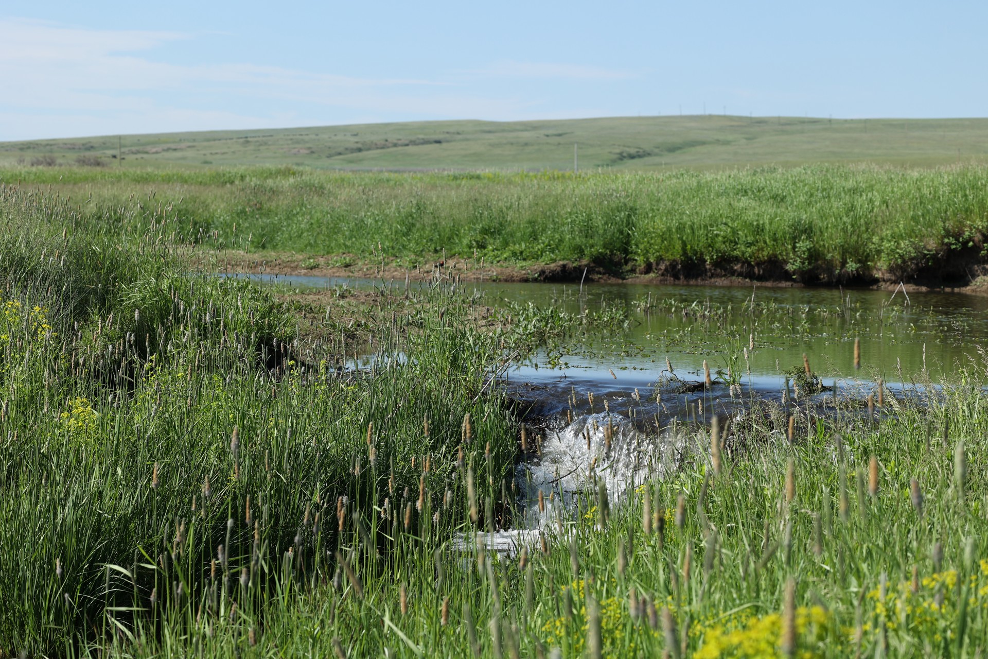
The Ross Fork Creek
is “amazing” Deb Biehl says. Starting in the Big Snowy Mountains south of Lewistown, Montana, the river runs through Fergus and Judith Basin providing irrigation, stock water and recreational opportunities to those who live alongside it. “It is just a beautiful waterbody,” Biehl said.
After teaching in the Hobson public schools, Biehl retired with her husband to their ranch near Buffalo, which has been in the family for over 80 years. Now, Biehl is a core member of the group monitoring conditions in the Ross Fork in partnership with Monitoring Montana Waters. This community-driven effort is working to gather information about water quality in the Ross Fork, which is designated as impaired by the Montana Department of Environmental Quality (DEQ), and to help inform the public and nearby landowners about the potential drivers of poor water quality.
When you don’t have data and there’s no policy to protect your land and your water, you’re pretty much defenseless when outside interests want to come in and want your water.
– Mike McDearmon, Central Montana Resource Council
The project began with a community meeting
titled “Hot chili, cold beer and clean water,” said Laurie Lohrer, a leading volunteer on the water monitoring effort and board member on the Central Montana Resource Council (CMRC), which oversees the monitoring project. Lohrer said that the resource council, founded in 2013, had extensive experience in holding community workshops and events when it decided to hold an event focusing on water quality featuring experts including MMW Program Leader Rachel Malison and Montana State University Assistant Professor Adam Sigler. Biehl, who was also involved in organizing the meeting, recalled that it was held on a cold day in January and that, before the meeting, the organizers were unsure who would attend. However, the event ended as a great success, Biehl said, with about 70 highly engaged attendees hearing the expert presentations and discussing water quality.
Lohrer said that a sign-up sheet passed around at this meeting furnished the initial volunteer base for the water monitoring effort. At the recommendation of Malison, Lohrer said that the group built off the momentum the meeting generated and applied to join MMW that year.
Mike McDearmon is a software designer was one of the writers on the application and helps process data for the monitoring group. He said that his interest in water began with growing up near Phoenix, Arizona and learning about the infrastructure that brings water to the Phoenix metro, as well as the water scarcity facing many rural Arizona communities. “When you don’t have data and there’s no policy to protect your land and your water, you’re pretty much defenseless when outside interests want to come in and want your water,” McDearmon said. He and his wife recently moved to Montana and she now serves as chair of the CMRC while McDearmon helps the monitoring group. “Now is the time to collect this information,” he said.
As the monitoring group formed,
Biehl worked with ranchers and landowners along the Ross Fork to get permission for the group to cross their land to take samples from the stream. She said that the group faced initial challenges, especially since this outreach began around the same time that many landowners received water rights adjudication notices from the state government, raising concerns that the monitoring effort was somehow connected. However, Biehl said that the group’s deep community connections and focus on building a “relationship of trust” with landowners on the stream let them overcome these concerns and secure stream access. Lohrer said they also emphasized that the group is focused strictly on fact finding and assessing the conditions in the stream, not “pointing any fingers at anybody.”
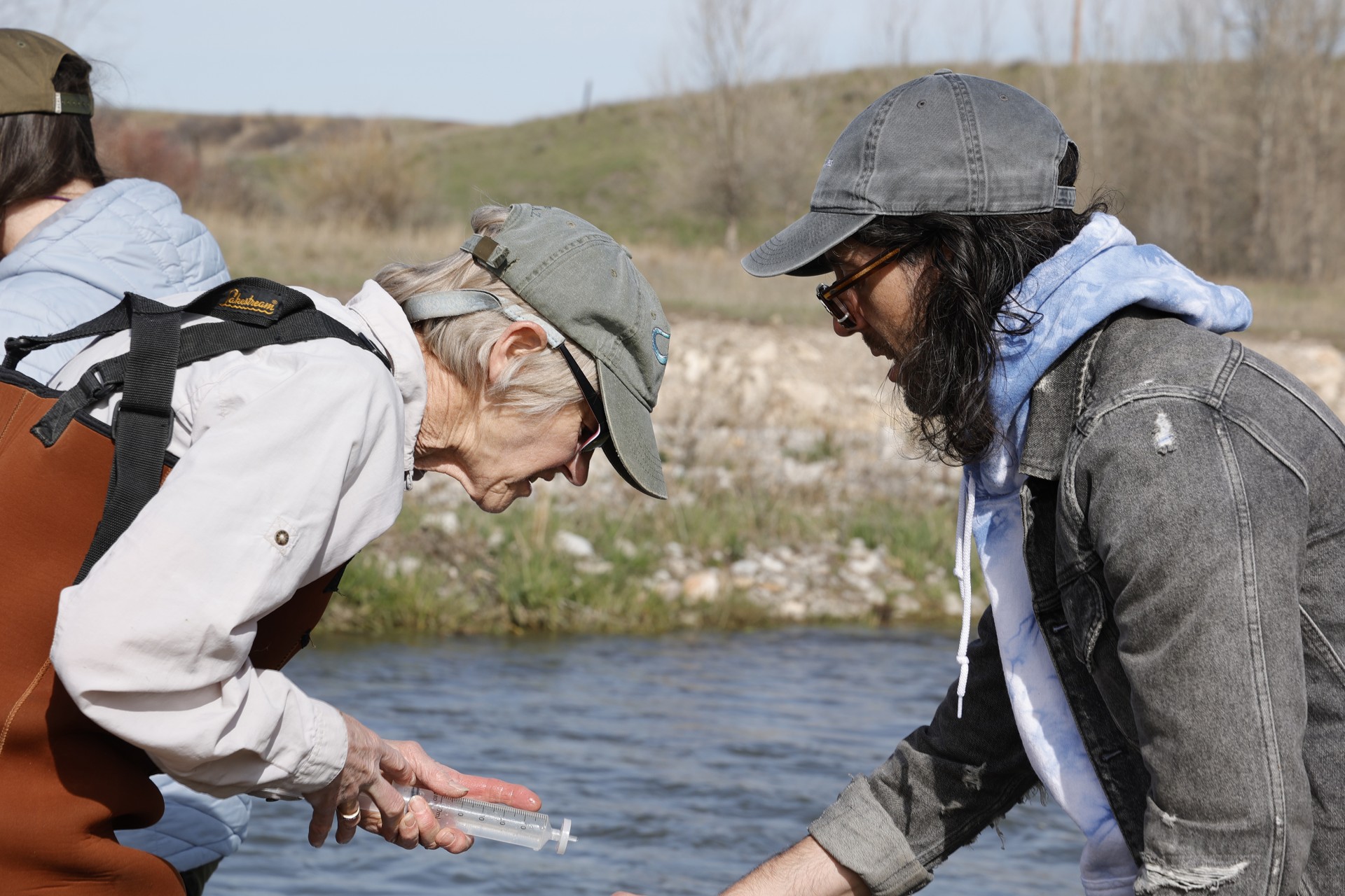
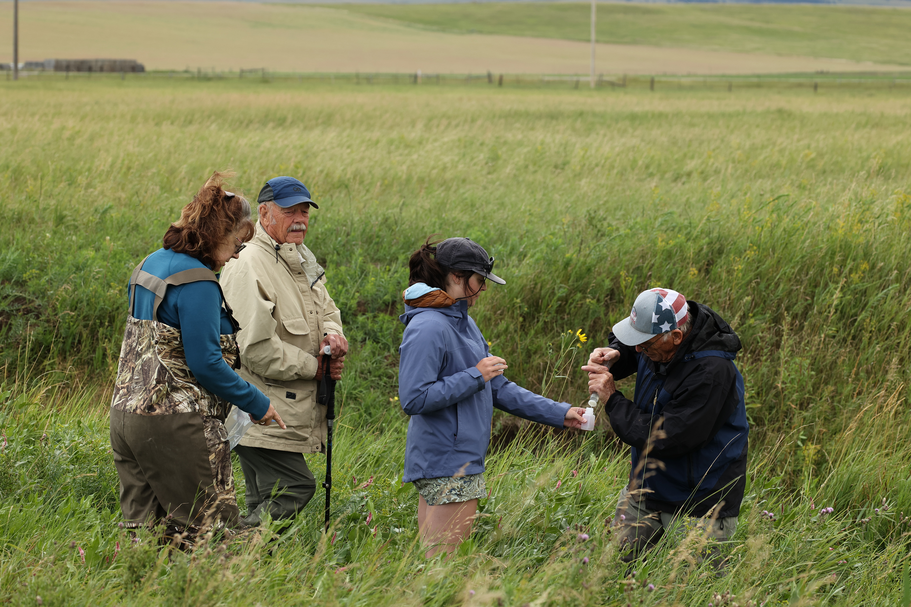
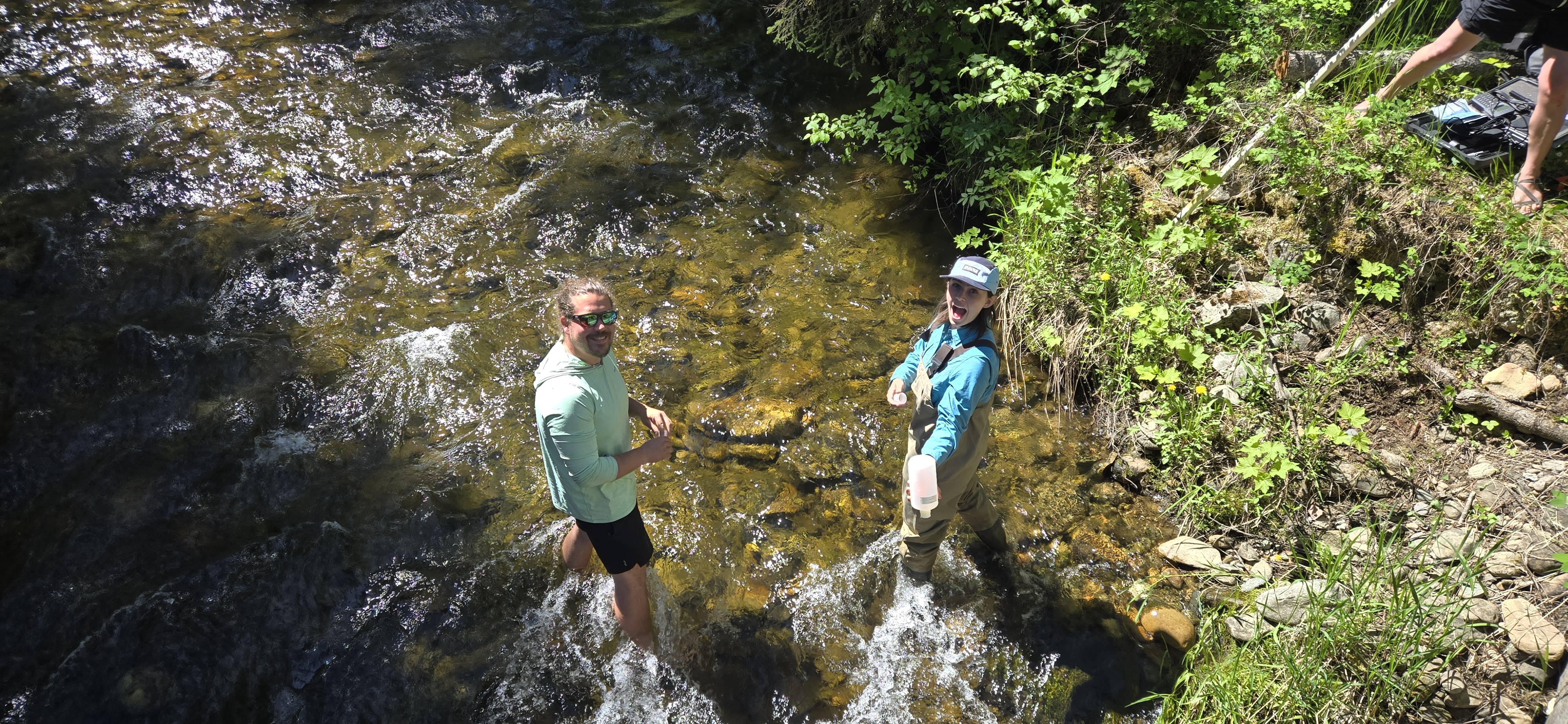
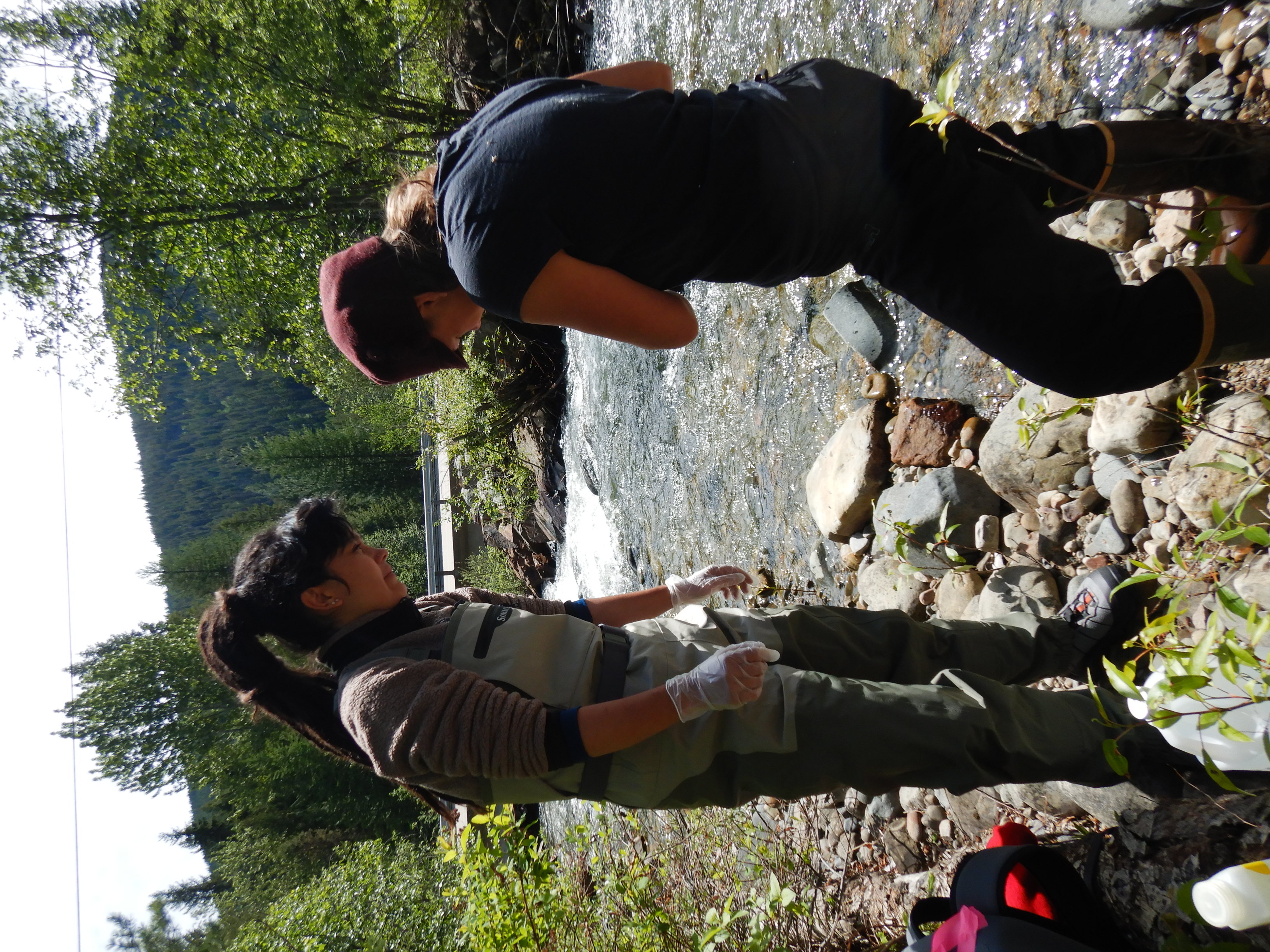
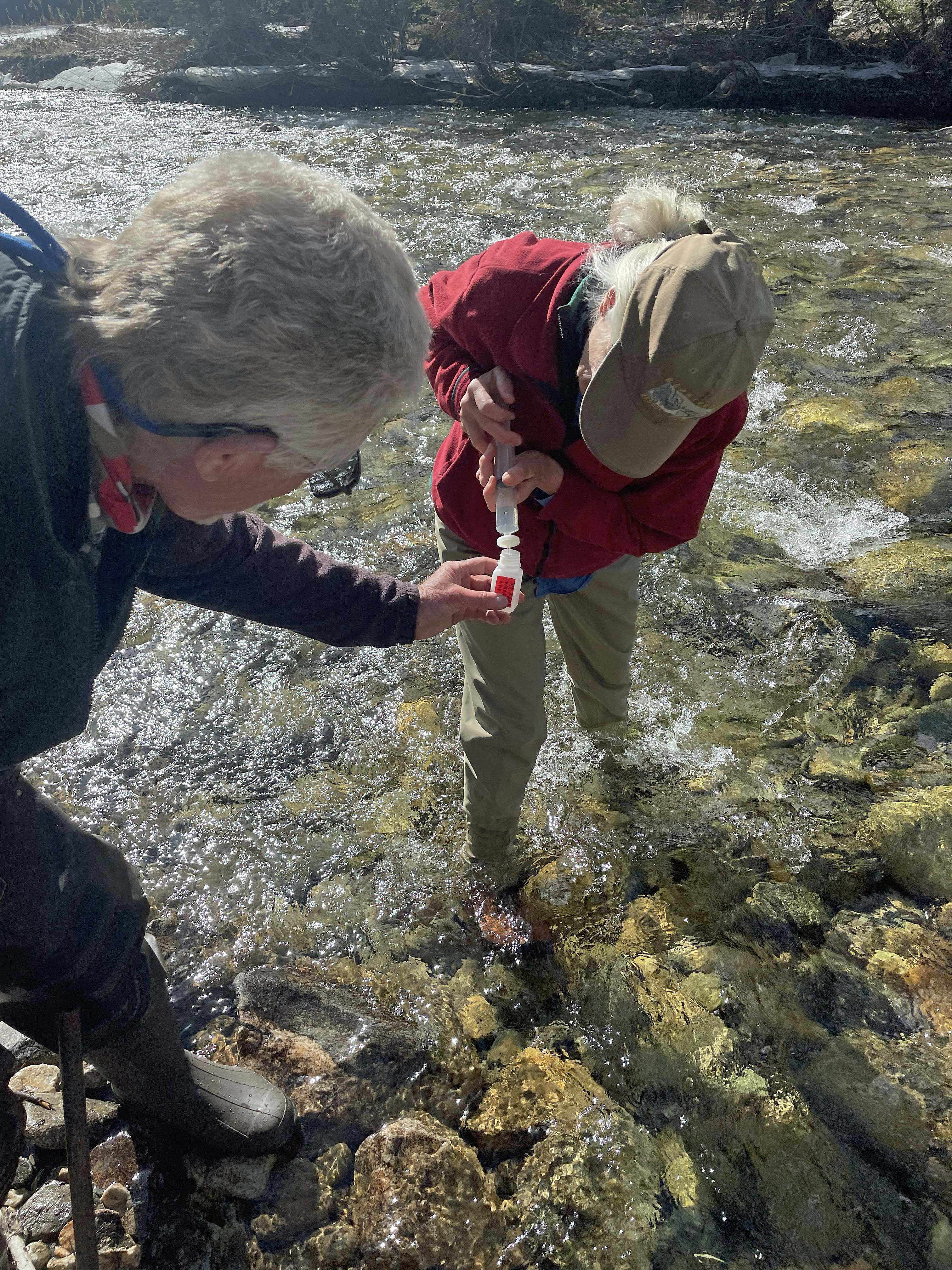
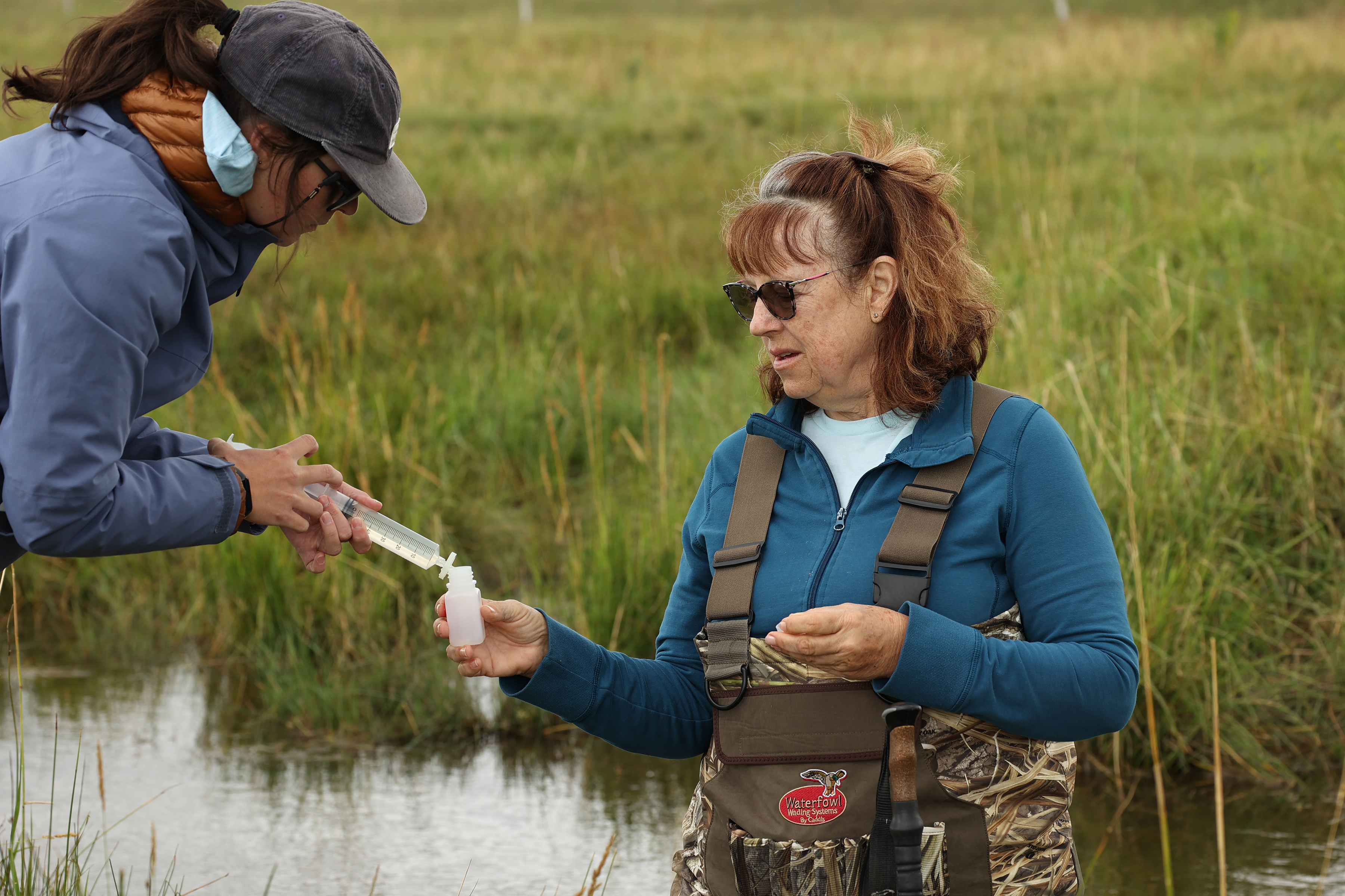
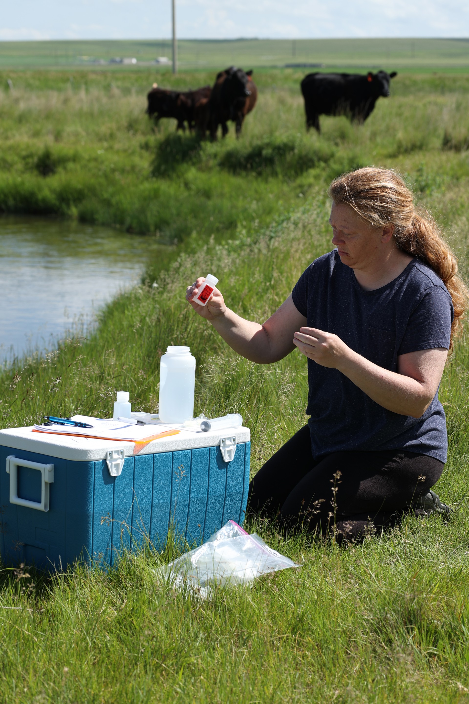
In 2024, the group did monthly monitoring of four sites
between July and September, while in the 2025 the group monitored five sites between May and September. Biehl said that the group has built a “pretty well-oiled system,” for each month’s monitoring trip. Lohrer sends emails to get the volunteer group organized while another volunteer, Linda Roche, packs coolers with water and snacks for the monitoring trip. The main monitoring trip happens on a Saturday, Biehl said, with the group taking samples to assess nutrients and oxygen levels in the water. Each trip takes between five and six hours, including breaks and snacks, and involves four to six volunteers traveling in two vehicles, Biehl said. Others wade into the water to take samples while she notes down their results. She said that she enjoys going on the trips and interacting with the volunteers in the group. “It’s nice to meet new people.”
The Thursday before, someone in the group typically accompanies a staff member from the Montana Department of Natural Resource Conservation (DNRC) office in Lewistown to take readings of water flow at each of the sampling sites. Biehl said that this partnership, where the DNRC supplies the flow testing equipment and a staff member to operate it, has enhanced the value of their water testing data.
After the first year of water monitoring,
Lohrer said that the CMRC group presented its data to community members and landowners along the Ross Fork at a February 2025 event called Hot Chili, Sweet Rolls and Ross Fork Creek. The event attracted about 40 attendees and had lots of “really great questions” during a question-and-answer session following the presentation, said Biehl. She said that the group was careful to not offer any conclusions about what their data might mean, since one year of data isn’t enough to draw clear conclusions according to MMW Program Leader Malison.
However, once the second year of data is collected and processed,
Lohrer said that the group will need consider where to go next. Biehl said that she hopes the program can do more to “educate people along the creek about what they can do to make their water clean and plentiful” in the future. McDearmon agreed, saying that he hopes that the monitoring can include more opportunities to “stop and chat” with the public, which is currently difficult given the remoteness of the group’s sites. McDearmon said that he hopes the data the group is collecting can help the area prepare for change. The project is one of the “little things we can do to protect our interests in a place,” he said.
Lohrer said that she wants to keep building an understanding of the Ross Fork’s condition and to stay focused on the personal and community connections that are key to the program’s success. “We just know that clean water, once it’s gone, you can’t get it back,” she said.
Water quality is fundamental to everything else.
– Brian Wheeler, Save Wild Trout
Much of the data collected with support from Monitoring Montana Waters
is ultimately used by volunteers for advocacy, both large and small. The (scientifically defensible and rigorously documented) data collected is used by groups to advocate for actions to improve water quality at venues from local forums to the offices of state policymakers and agencies. Having rigorous data can make water quality problems easier to understand and provide evidence that action is needed. It can also help determine what the sources of a water quality problem might be and offers a starting point for how to address identified problems. Together, the data collection that MMW helps facilitate provides a strong resource for groups working to inform their community about water quality challenges and present local policymakers with the information needed to make informed decisions to support clean waters.
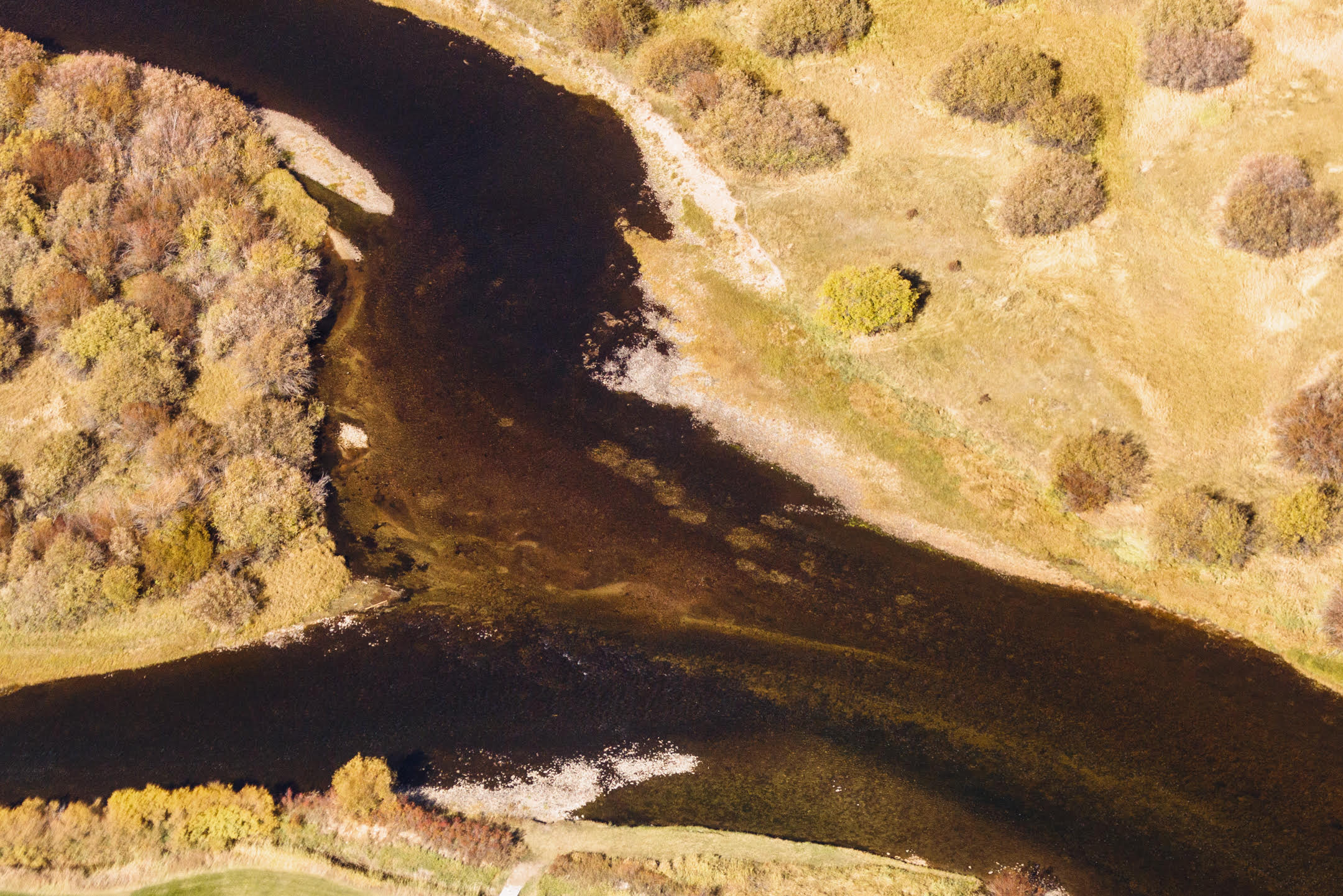
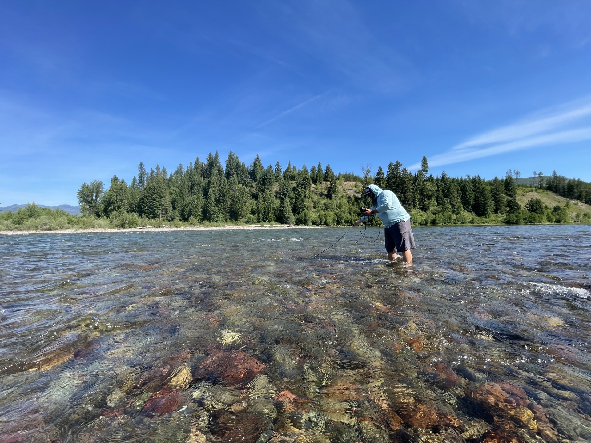
On the Big Hole River in southwest Montana,
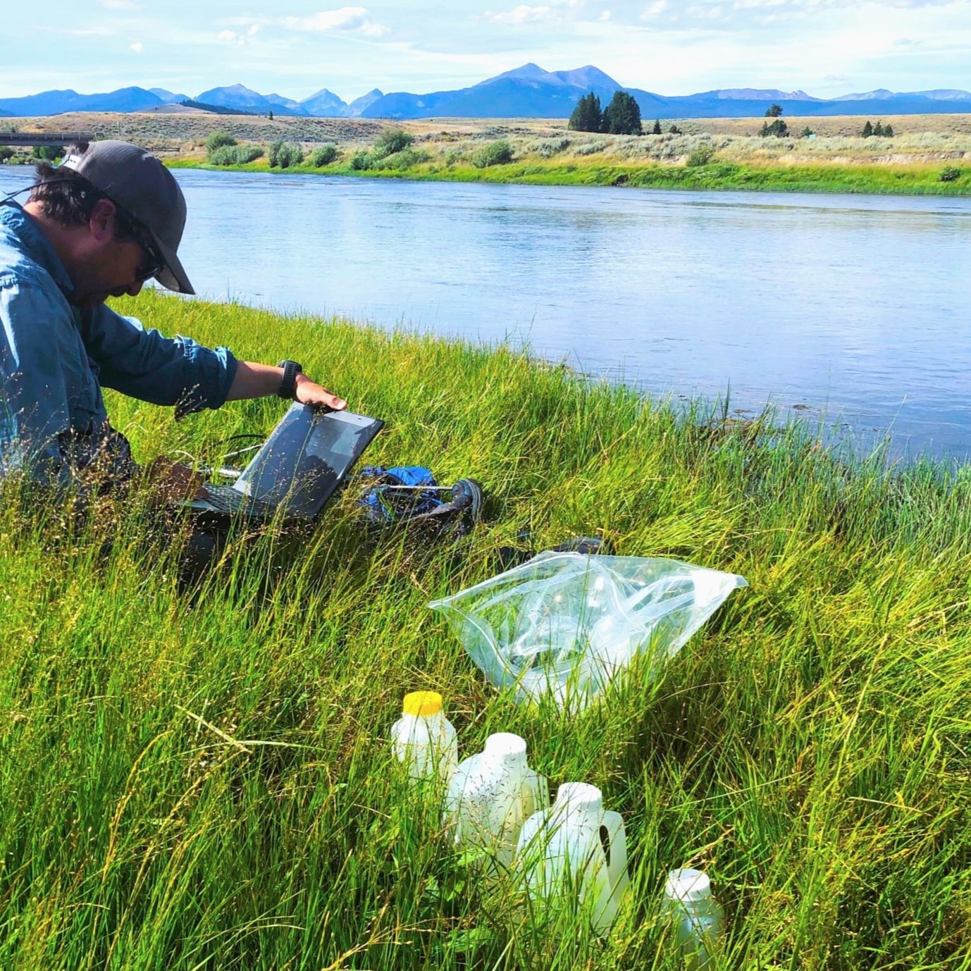
Monitoring Montana Waters is helping support efforts to protect water quality and trout in this (blue ribbon) stream. The river faces a variety of threats, said Brian Wheeler, program director for Save Wild Trout, an organization that advocates for trout conservation in the Big Hole River and elsewhere in southwest Montana. These threats include high water temperatures, low river flows and high concentrations of nutrients like nitrogen and phosphorus, he said. These pressures have likely contributed to the grisly kills of brown trout occurring on the river, Wheeler said, as the cumulative pressures of the stresses upon them harm the fish and leave them open for necrosis and fungal infections. River guiding and the trout fishery are pillars of the local economy, said Wheeler, along with farming which draws irrigation water from the river. “The ecology is suffering and it doesn’t take long for the economy connected to the ecology to suffer,” he said. “A whole lot of jobs and families depend on the health of these resources.”
Wheeler served as the executive director of the Big Hole River Foundation (BHRF) until recently, when BHRF merged with Save Wild Trout. Overarching efforts continue to advocate for expanded trout conservation measures with state and federal agencies, and Wheeler said that water monitoring has become a central aspect of the group’s work. “Water quality is fundamental to everything else,” he said.
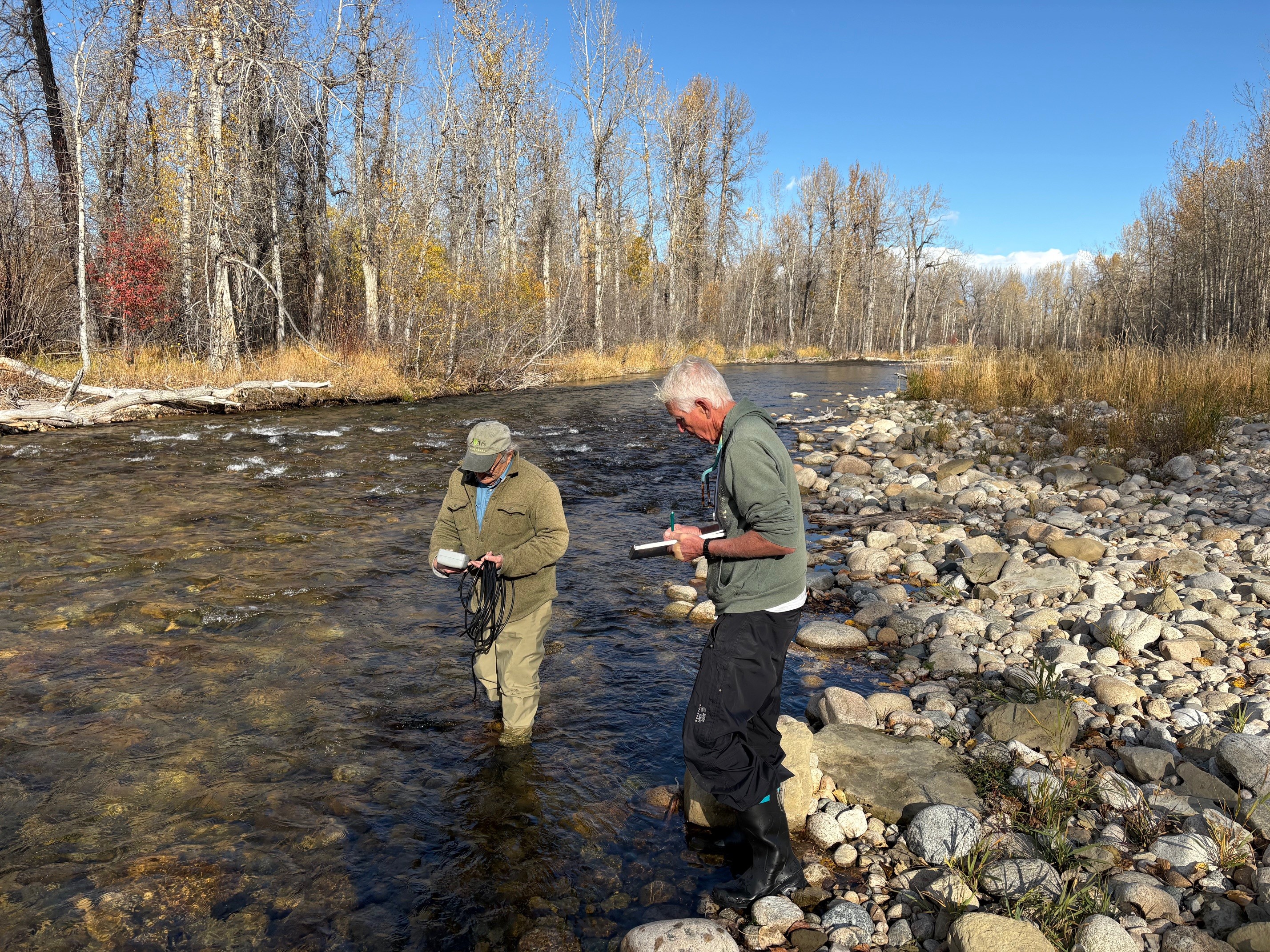
The organization’s water monitoring efforts started in 2019,
with the BHRF beginning a water monitoring project in the Big Hole approved by the Montana Department of Environmental Quality (DEQ). In developing this project, Wheeler explained that the group got into contact with Rachel Malison, Program Leader of the MMW program, through a BHRF board member. In 2020 Malison helped the group expand its monitoring program Wheeler said, opening a lengthy partnership between water monitoring in the Big Hole and Malison’s water monitoring efforts. When the monitoring program started, Wheeler said that the organization expected the Big Hole’s waters to be “relatively pristine.”
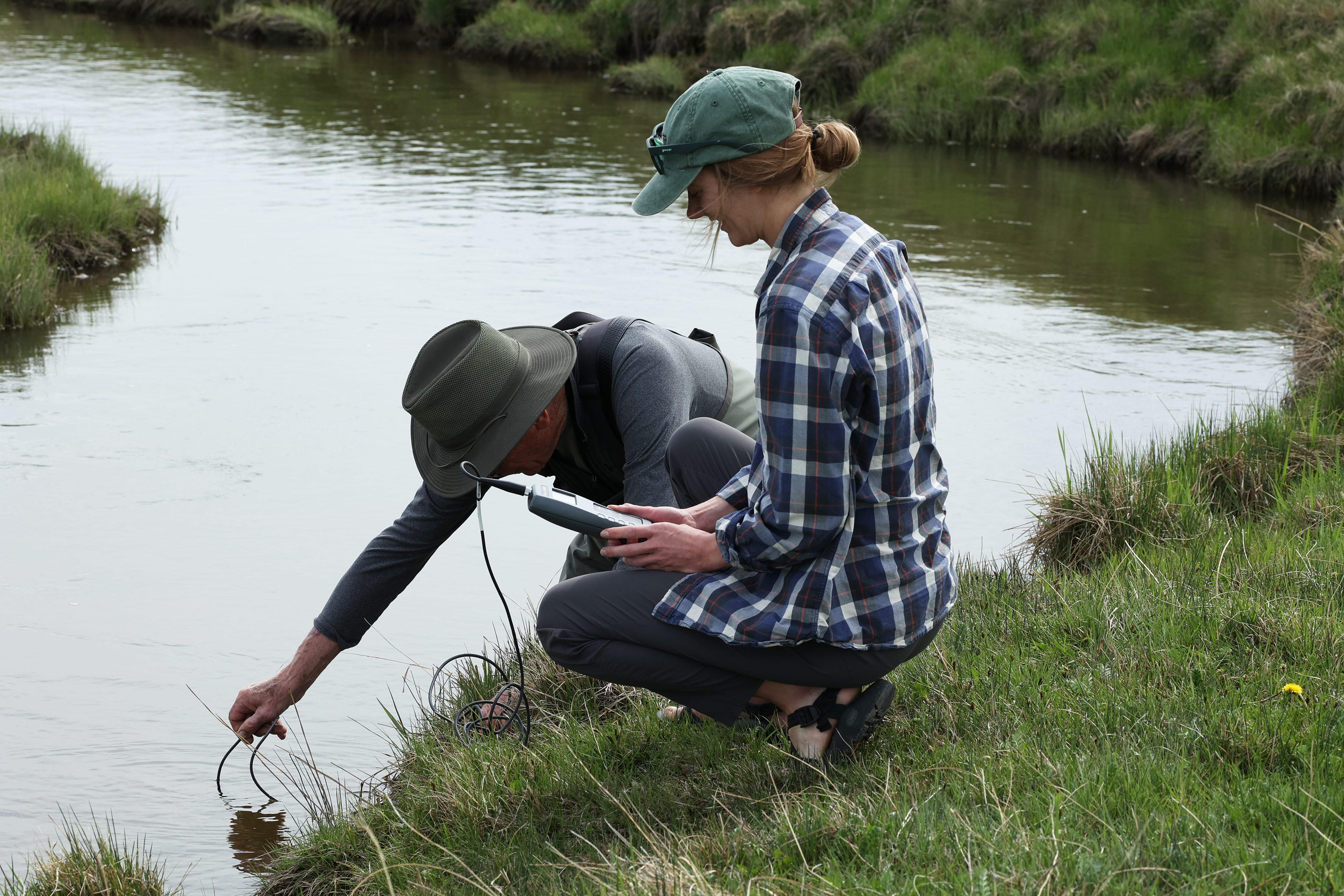
However, monitoring quickly found that levels of nutrients in the Big Hole regularly exceeded the (DEQ) standards for healthy levels of nutrients like nitrogen and phosphorus. This finding led to a shift in the monitoring effort, Wheeler said, which refocused on documenting the high nutrient levels to support further research and advocacy. When MMW launched in 2020, it was a “perfect fit” for BHRF’s water monitoring efforts, said Wheeler, providing technical support and funding to help the program take accurate, scientifically defensible samples. The Big Hole project has been part of MMW since its inception and currently involves monthly sampling of 10 sites on the Big Hole River and tributaries. These test levels of nitrogen and phosphorus, water temperature, the amount of dissolved oxygen and other characteristics in the river. The MMW program provides scientific guidance on planning water monitoring, as well as funding for laboratory analysis of many of the samples that the BHRF collects. Wheeler said that participating in the program, as well as the Volunteer Monitoring Lab Analysis Support Program run by DEQ, gives the group a significant discount on analysis of the remaining water samples at the lab. “They’re been generous and really helped us out,” he said about MMW.
The sampling helps the group
keep track of changing river conditions and furthers their advocacy for the river, Wheeler said, enabling them to take actions like filing detailed petitions for more rigorous river health standards or providing supplementary water quality data for ongoing studies of brown trout die offs.
In 2025, Wheeler said the BHRF took its next step towards expanding its water quality data collection efforts by merging with Saving Wild Trout. Saving Wild Trout is a trout conservation group focused on the Jefferson Basin, which contains the Big Hole, Ruby, Beaverhead and Jefferson rivers. Merging with the larger group will allow the water monitoring efforts to expand from the Big Hole to all four rivers in the Jefferson Basin, Wheeler said, broadening the reach and impact of the water quality monitoring work. This merger will expand the monitoring to 25 sites across the four rivers, in addition to an ongoing project monitoring changes in numbers and types of river invertebrates.
The issues on the Big Hole
can be “kind of overwhelming,” Wheeler said, driven or exacerbated by global forces like rising temperatures or changing weather patterns. However, he said that monitoring and improving water quality is something where individuals can make a difference, whether in helping with citizen science projects like Save Wild Trout’s river monitoring or curtailing their own fertilizer and pesticide use to improve water quality. “Individual actions do add up,” Wheeler said, and taking simple actions to prevent damaging the river can reduce pressure on the creatures in it and keep it healthy in the future. “It’s easy to be overwhelmed by problems,” said Wheeler. However, he applies his energy locally to issues like water quality because “that’s the only place that I as an individual am able to have an impact.”
Wheeler hopes that individual actions and continued advocacy will lessen the strain on the Big Hole River and the creatures that live in it. He said that he wants to see the river thrive, not just to stave off disaster. “I'd like to see this renowned and ecologically unique and sensitive watershed protected and enhanced as a headwater source of one of the nation's great rivers,” Wheeler said.
The groups involved in MMW
are primarily clustered in western and central Montana. Although MMW-supported monitoring efforts include many of Montana’s iconic waterways, expanding the program’s reach is a key goal for the future. Water monitoring is critical to understanding and maintaining healthy river environments and many Montana waterways, particularly in eastern Montana, are less well studied. These rivers have great value to local communities and environments and they face significant threats.
Another objective is to support other research and monitoring efforts at FLBS to expand the range of water parameters that are monitored and analyzed for in Montana. MMW-affiliated groups primarily monitor for many nutrients, sediment, metals and other physical water characteristics. MMW has been working closely with the Montana Pesticide Stewardship Partnership Program, also based at the Flathead Lake Biological Station, to help expand pesticide monitoring in western Montana. However, there are still many types of contaminants that are not assessed by the program and are not part of state-wide monitoring programs, including forever chemicals like PFAS and pharmaceuticals. These substances may also pose threats to (both environmental and human health), but are currently not sufficiently monitored in Montana waterways. Our aim is for MMW to help support future work to expand monitoring of such contaminants and help understand their impacts on our waters.
All this monitoring work is not possible without philanthropic support. If you are interested in supporting MMW and protecting Montana’s waters for the future, contact Rachel Malison at rachel.malison@flbs.umt.edu or by phone at (406) 872-4518. Your support makes this program a reality.
For five years,
Monitoring Montana Waters has helped communities understand and monitor the water in their rivers and streams. MMW support has helped track the threat of selenium in the Kootenai River, build baseline water data in Rock Creek, keep the Flathead River wild and scenic, understand water conditions in the Ross Fork and advocate for trout in the Big Hole. MMW Program Leader Rachel Malison said that she hopes, with ongoing philanthropic support and engagement from Montana communities, the program can grow into the future and keep doing its essential work of keeping Montana waters clean. “All of life needs water,” she said. “For all uses, for all users, all of life needs water.”
The MMW Five Years article can be found broken into two parts in the links below:
Five Years of MMW Part 1 (Pages 1-12)
Five Years of MMW Part 2 (Pages 13 25)
Credits
Words and Layout: Josh Pike
Editing: Rachel Malison, Brianne Elizondo, Jessica Vizzutti
Photos Courtesy: Big Hole River Foundation, Paige Weigand, Carbon County Resource Council/Rock Creek Watershed Group, Central Montana Resource Council, Flathead Rivers Alliance, Josh Pike, Rachel Malison, Monitoring Montana Waters Staff, Save Wild Trout, Yaak Velly Forest Council